WLC Partners with UVIC Computer Science Student to Improve Whale Monitoring Data
The W̱SÁNEĆ Marine Guardians / QENTOL, YEN has recently partnered with UVic computer science graduate student Bachan Ghimire to help protect the KELȽOLEMEĆEN / Killer Whales.
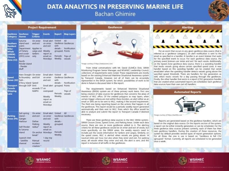
Shown above: Bachan Ghimire’s final presentation at UVIC on using Data Analytics to preserve Marine Life
As part of the Federal Government’s Ocean Protection plan, the Enhanced Maritime Situational Awareness (EMSA) Initiative was developed specifically to provide Coastal Indigenous Groups with in-depth data on marine activity in their territory.
As part of EMSA, David Dick, the Senior Manager of the SRKW Monitoring program, will receive thousands of emails a day with alerts on vessel traffic, weather, hydrography.
Shares David, “It’s another resource for us that the Canadian Government has provided. I am getting data on marine speed zones, parking zones and other data, but the data isn’t useful to me the way it’s formatted now.”
Continues David, “It’s not enough to get access to the data; we need to be able to analyze it and understand what is happening and then decide what we are going to do about it. It comes from the need to protect our interests and scarce resources.”
The requirement to adapt the streams of raw data from EMSA into customized reports just happens to be Bachan Ghimire’s area of expertise. A 2018 Computer Science and a 2021 M.Sc. Project Management graduate Bachan is now working on his second Master’s at UVIC in Computer Science which gives him the option to work on a directed-studies project. He and David worked together for four months to determine the objectives and outcomes of the project.
Bachan shares, “It feels awesome to work on this project with the W̱SÁNEĆ Marine Guardians. My background in Computer Science means I have so much leverage as I know my way around data, and to use it for something that has a positive impact on the environment, feels great.”
The primary objective of the project is to transform the thousands of emails going into David’s inbox into one, easy to read report, delivered every Monday.
“Right now there are geofences set up around the protected areas,” Bachan explains. “These geofences capture data on every single vessel that enters these waters. No one enters these areas without us knowing about it, and we get instant alerts if they overspeed or enter restricted closure zones.”
Included in the reports is data on the closure zones, the speed zones, and the parking areas for tanker and cargo vessels. The areas that are being monitored are the Saturna Island East Point Department of Fishery and Ocean zone (DFO), Haro Strait & Boundary Path, D’Arcy Island, Salt Spring Island, South Pender, Saturna Island and the Saanich Inlet.
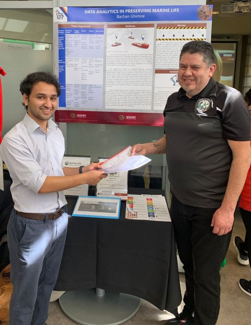
At the end of the project, Bachan shared his data at a celebratory event at UVIC where all students working on community projects presented their findings.
Monitoring Program Senior Manager David (SUMÉ,t) Dick and computer science student Bachan Ghimire at a celebratory event at UVIC.
Shares Bachan, “This project has certainly opened my eyes about the environment and what’s going on in the world, I now have a better understanding of the bigger picture and the extent of possibility to create with computer science.”
David (SUMÉ,t) Dick is just as pleased with the outcome of the project, “Bachan helped us put everything together so it will work for us in the Program. I am so grateful for my education and I am always looking for ways to give back, so this was a perfect opportunity to give back to education and for us at the Guardians. I am really grateful for all the work Bachan has done so far.” David laughs “It’s definitely less stressful to get one report instead of a thousand emails.”
The collected data will be analyzed and will help further the objectives of the W̱SÁNEĆ Marine Guardians / QENTOL, YEN program which are:
To restore the relationship between the whales and the W̱SÁNEĆ people,
Working with like-minded allies to help the whales thrive,
Protecting the whales from the negative impact of industry,
Ensuring they have an adequate food supply


